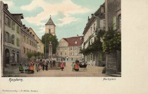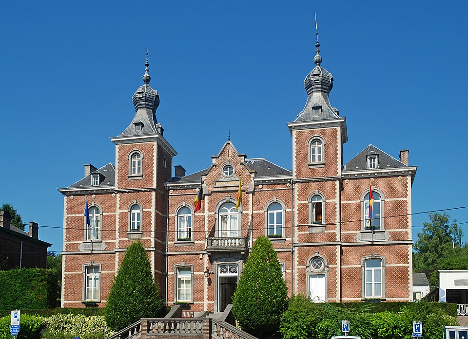
Ottignies – town hall
Introduction
The town of Ottignies does not announce itself in the way great European capitals do. There are no imperial palaces, no decisive battles that altered the course of continents, and no single moment that defines its identity. Instead, its history unfolds in a quieter but more traceable way—through geography, administrative evolution, infrastructure, and institutional transformation.
Today, as part of the municipality of Ottignies-Louvain-la-Neuve, it stands at the intersection of two worlds: a historically rooted town and a modern university city. What makes Ottignies significant is not dramatic rise or decline, but continuity—its ability to absorb change while remaining recognizably itself. Every stage of its development can be traced through verifiable records, making it a useful case study in how European communities evolve over time.
Beginnings Along the Dyle: Name and Landscape
The earliest identifiable traces of Ottignies come not from ruins or monuments, but from language. Medieval documents preserve the name in forms such as Otingniacum, which reflects a widely recognized naming pattern across former Roman territories. The suffix -acum typically indicated a rural estate, while the root derives from a personal name—most likely Ottinius or a similar form.¹
This does not mean that Ottignies can be definitively identified as a specific Roman villa site. No archaeological evidence confirms such a structure at the exact location. Rather, the name reflects a linguistic inheritance from a period when landholding identities shaped place names across the region.²
What is certain—and far more influential—is geography. Ottignies developed along the Dyle River, a modest but significant waterway running through central Belgium. The Dyle valley provided fertile soil, access to water, and a natural route for movement.³ These conditions consistently attracted settlement throughout European history, and Ottignies follows that pattern precisely.
The river did not make Ottignies powerful, but it made it viable—and that distinction explains much of its long-term continuity.
A Medieval Village: Stability Without Expansion
By the medieval period, Ottignies had taken on the recognizable form of a rural European village. It existed within the Duchy of Brabant and operated under the feudal structures that defined the region. Land was held by local authorities—either secular lords or ecclesiastical institutions—and worked by tenant farmers.⁴
At the center of this community stood the parish church. The site associated with Saint Remy Church Ottignies represents this enduring institutional presence. While the current structure includes later modifications, the existence of a parish there reflects a continuous pattern of religious and administrative organization.⁵
Life in medieval Ottignies was structured around agricultural cycles. Fields were planted and harvested according to the seasons, and obligations to landholders shaped economic relationships. The church calendar marked time as much as the sun and soil did.
Importantly, Ottignies did not develop into a fortified town or a regional market center. It remained a village—connected to nearby towns such as Wavre and Nivelles, but not transformed by those connections.⁶ This lack of rapid expansion is not a gap in its history; it is its defining feature. Ottignies endured by remaining stable.
Through Empires and Revolutions: Change Without Disruption
Between the 16th and 18th centuries, the region experienced profound political shifts. Control passed through Spanish and Austrian Habsburg rule before the upheaval of the late 18th century.⁷
Yet, for Ottignies, these transitions were largely administrative. There is no evidence that the town became a strategic military site or a focal point of conflict. Its agricultural character persisted, and its population remained relatively small.
The reforms of the French Revolution introduced more concrete change. Feudal privileges were abolished, and governance was reorganized into a centralized administrative system.⁸ Land ownership patterns shifted, and the relationship between local populations and authority was fundamentally altered.
Even so, daily life retained continuity. Fields were still worked, the parish still functioned, and the rhythms of rural existence remained intact. The transformation was structural, not experiential.
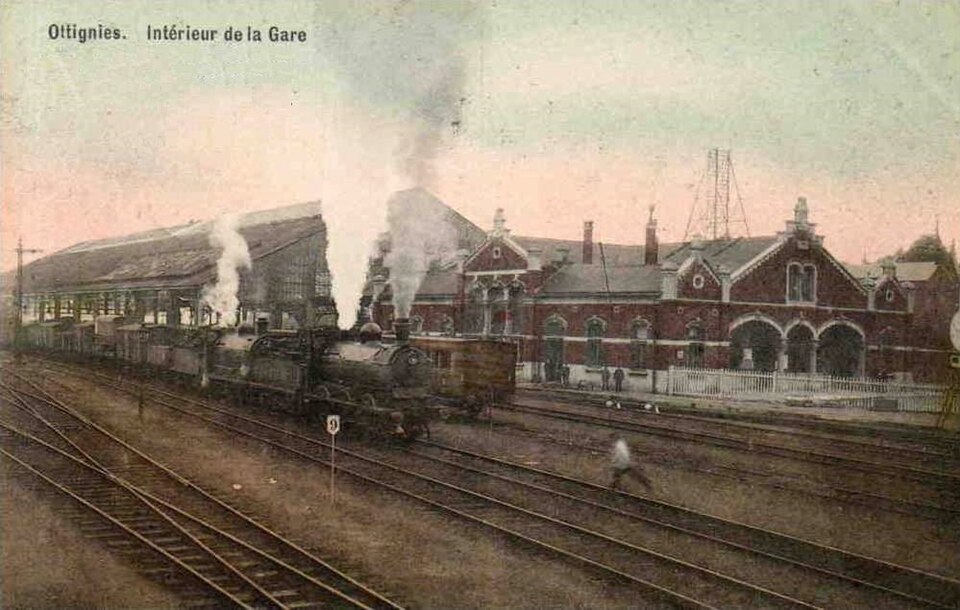
The Railway Arrives: A Measurable Turning Point
The first clearly documented and transformative shift in Ottignies’ development came in the 19th century.
Following Belgian independence in 1830, the country invested heavily in railway infrastructure. In 1855, the Ottignies railway station opened, placing the town directly into the national transportation network.⁹
This was not a minor addition. Railway records confirm that Ottignies became a junction linking major lines, including routes connecting Brussels, Namur, and Leuven.¹⁰
The effects were immediate and observable, as new residents—many connected to railway operations—arrived in the area, housing expanded around the station, and commercial activity increased with the steady movement of goods and people through the town.
For the first time in its history, Ottignies was no longer defined solely by land. It became defined by movement.
This transition—from agrarian stability to infrastructural relevance—is one of the most important and well-documented phases in the town’s history.
A New City Emerges: Louvain-la-Neuve
The most dramatic transformation came more than a century later, and it was driven not by industry but by education and national politics.
In 1968, linguistic tensions in Belgium led to the division of the Catholic University of Leuven. The French-speaking section required relocation.¹¹ The decision that followed was unprecedented: rather than moving into an existing city, the university chose to build a new one.
That city became Louvain-la-Neuve, constructed on land adjacent to Ottignies beginning in 1969.¹²
Urban planning research confirms that Louvain-la-Neuve was designed as a fully integrated city rather than a traditional campus.¹² Its defining characteristics include a pedestrian-focused layout, mixed-use development, and a unified planning vision.
Transformation of the Landscape
The creation of Louvain-la-Neuve brought rapid and measurable change to the region surrounding Ottignies.
Areas that had been used for agriculture for generations were converted into urban infrastructure within a relatively short time frame.¹² This transition is supported by land records, planning documents, and academic studies.
Unlike earlier phases of the town’s history, which must often be reconstructed from indirect evidence, this transformation is thoroughly documented. It represents a rare case in Western Europe of a large-scale, purpose-built city emerging in the modern era.
A Dual Identity: Ottignies Today
Today, Ottignies-Louvain-la-Neuve reflects a dual structure that is both functional and cultural.
Ottignies itself remains primarily residential and infrastructural, retaining its historical continuity. Louvain-la-Neuve, by contrast, serves as a major academic and cultural center shaped by the presence of UCLouvain.¹¹
This combination produces a distinctive environment in which long-established residential neighborhoods exist alongside student housing, local routines coexist with international academic life, and a clear sense of historical continuity meets the realities of modern institutional development. The relationship between the two is not accidental—it is the result of documented planning decisions and historical necessity.
What Defines Ottignies
The identity of Ottignies can be understood through a set of clearly verifiable characteristics:
- It is a historical settlement shaped by river geography³
- It became a railway junction of regional importance in the 19th century⁹
- It is directly connected to the creation of one of Europe’s few planned university cities¹²
- It exists today as part of a dual municipality combining historical continuity with modern academic life¹¹
Each of these elements is supported by documented evidence and reflects a distinct phase of development.

Conclusion
Ottignies does not rely on legend to explain its past. Its history is preserved in records—linguistic, administrative, infrastructural, and institutional.
From a named estate in early records to a medieval farming village, from a railway junction to a partner in a modern university city, its development can be traced with clarity. Each transformation is grounded in verifiable change rather than interpretation.
What emerges is not a story of sudden rise, but of steady adaptation. Ottignies endured because it remained responsive to the forces around it—geographic, political, industrial, and academic.
That continuity, supported by documentation rather than assumption, is what defines it.
Endnotes
- Walloon historical toponymy: https://connaitrelawallonie.wallonie.be
- Roman-era naming conventions in Gaul: https://www.vlaamse-erfgoedbibliotheek.be
- “Dyle River”: https://en.wikipedia.org/wiki/Dyle
- “Brabant,” Encyclopaedia Britannica: https://www.britannica.com/place/Brabant
- Château d’Ottignies and Saint Remy Church:
https://connaitrelawallonie.wallonie.be/culture-et-patrimoine/patrimoine/chateau-dottignies-et-eglise-saint-remy - Regional geography of Belgium: https://www.britannica.com/place/Belgium
- Political history of the Southern Netherlands: https://www.britannica.com/place/Belgium/History
- “French Revolution,” Encyclopaedia Britannica: https://www.britannica.com/event/French-Revolution
- “Ottignies railway station”: https://en.wikipedia.org/wiki/Ottignies_railway_station
- Belgian railway system: https://www.belgiantrain.be
- UCLouvain institutional history: https://www.uclouvain.be/en/faculties/fial/historique
- Pierre Laconte, The Founding and Development of Louvain-la-Neuve:
https://www.ffue.org/wp-content/uploads/2016/07/IPHS_160718-Book-Historical-perspectives-article-Laconte.pdf - Louvain-la-Neuve timeline:
https://visitwallonia.com/en-gb/3/where-to-go/walloon-towns-and-cities/ottignies-louvain-la-neuve - Cultural overview:
https://visitwallonia.com/en-gb/3/where-to-go/walloon-towns-and-cities/ottignies-louvain-la-neuve